2013
NS4276 : Path near the Overtoun Burn
taken 10 years ago, near to Bellsmyre, West Dunbartonshire, Scotland
This is 1 of 3 images, with title Path near the Overtoun Burn in this square
Path near the Overtoun Burn
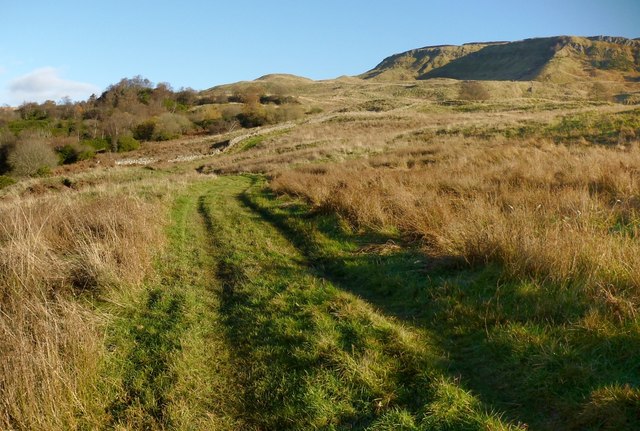
This is a view from further along the path shown in NS4276 : Path near the Overtoun Burn. NS4376 : The Long Crags are on the right, and NS4377 : Roundwood Hill is just left of centre. The wooded area on the left contains a NS4377 : Disused quarry.
Lang Craigs Woodland :: NS4377
The woodland occupies 240 hectares (590 acres) that were acquired by the Woodland Trust Scotland in 2011. It is named after the Long Crags (or Lang Craigs), a line of cliffs Link making up the facade of the Kilpatrick Hills plateau. Lang Craigs Woodland is one of the 13 Commonwealth Woods, and is an SSSI (Site of Special Scientific Interest). New paths have been laid out (waymarkers were added in May 2015), and about 160 hectares of new native woodland planted.
 Map © Crown Copyright")
TIP: Click the map for more Large scale mapping
- Grid Square
- NS4276, 215 images (more nearby 🔍)
- Photographer
- Lairich Rig (more nearby)
- Date Taken
- Saturday, 23 November, 2013 (more nearby)
- Submitted
- Thursday, 5 December, 2013
- Subject Location
-
OSGB36:
 NS 4273 7699 [10m precision]
WGS84: 55:57.6059N 4:31.2518W - Camera Location
-
OSGB36: NS 4272 7698
- View Direction
- North-northeast (about 22 degrees)