2013
TG3533 : Storm surge damage, Walcott
taken 10 years ago, near to Walcott, Norfolk, England
This is 1 of 2 images, with title Storm surge damage, Walcott in this square
Storm surge damage, Walcott
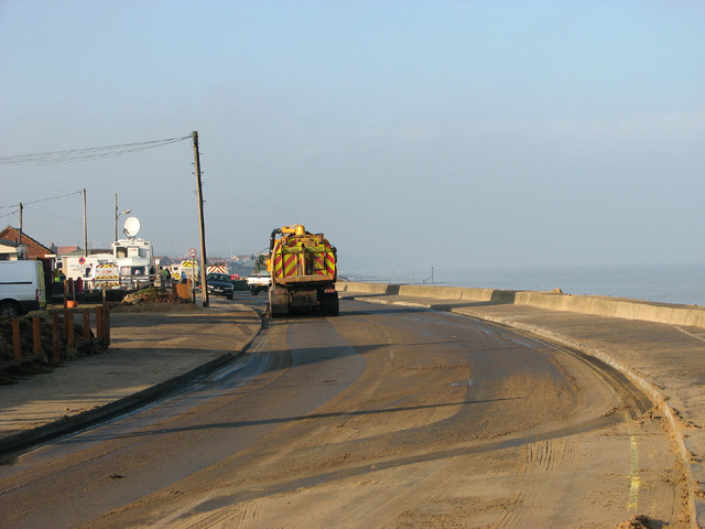
A highway maintenance lorry is driving backwards and forwards, sweeping the sand off the main coast road through Walcott. Clean-up in progress. On 5 December 2013, a storm surge, said to have been the worst in 60 years, flooded the coastal village of Walcott. Five days later, the main road through the village is still closed > Link and workers are busy removing lots of sand which had been washed onto it. A number of sea front chalets were destroyed or badly damaged by flood water, and gardens and side roads are still covered with debris. People from 13 homes have been moved into emergency accommodation. The public footpath leading along the top of the sea wall is also still closed > Link.
 Map © Crown Copyright")
TIP: Click the map for more Large scale mapping
- Grid Square
- TG3533, 128 images (more nearby 🔍)
- Photographer
- Evelyn Simak (more nearby)
- Date Taken
- Tuesday, 10 December, 2013 (more nearby)
- Submitted
- Tuesday, 10 December, 2013
- Subject Location
-
OSGB36:
 TG 3580 3303 [10m precision]
WGS84: 52:50.5872N 1:29.9988E - Camera Location
-
OSGB36: TG 3584 3301
- View Direction
- West-northwest (about 292 degrees)