2013

SK4523 : Ridges and furrows

taken 10 years ago, near to Diseworth, Leicestershire, England
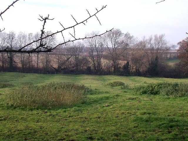
Ridges and furrows
Ridges and furrows
The ridges and furrows of medieval strip farming are visible in several of the fields south of Diseworth

Creative Commons Licence [Some Rights Reserved]   © Copyright Ian Calderwood and licensed for reuse under this Creative Commons Licence.
Geographical Context: Historic sites and artefacts Farm, Fishery, Market Gardening Village, Rural settlement other tags: Ridge and Furrow Strip Farming Field Medieval Click a tag, to view other nearby images.
This photo is linked from: Automatic Clusters: · Diseworth [7] · Field [4] · Farm [2] · South of Diseworth [2] Other Photos: · Horses grazing in a ridge and furrow field ·
1:50,000 Modern Day Landranger(TM) Map © Crown Copyright
+
+
1:50,000 Modern Day Landranger(TM) Map © Crown Copyright
TIP: Click the map for more Large scale mapping
Grid Square
SK4523, 21 images   (more nearby 🔍)
Photographer
Ian Calderwood   (more nearby)
Date Taken
Wednesday, 11 December, 2013   (more nearby)
Submitted
Wednesday, 11 December, 2013
Subject Location
OSGB36: geotagged! SK 4506 2387 [10m precision]
WGS84: 52:48.6301N 1:19.9769W
Camera Location
OSGB36: geotagged! SK 4512 2385
View Direction
West-northwest (about 292 degrees)
Clickable map
+
NW N NE
W Go E
SW S SE
Image classification(about): Geograph
This page has been viewed about 50 times
You are not logged in login | register