2013
SX9151 : A ploughed field and the coast towards Man Sands
taken 10 years ago, 3 km from Kingswear, Devon, England
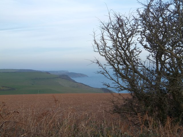
A ploughed field and the coast towards Man Sands
Berry Head is just visible as the furthest promontory. The South West Coast Path follows the cliff-top
South West Coast Path
The South West Coast Path National Trail - 630 miles of superb coastal walking. From Minehead on the edge of the Exmoor National Park to the shores of Poole Harbour in Dorset. It is the longest of all Britain's National Trails.
Website: Link
 Map © Crown Copyright")
TIP: Click the map for more Large scale mapping
- Grid Square
- SX9151, 78 images (more nearby 🔍)
- Photographer
- David Smith (more nearby)
- Date Taken
- Wednesday, 11 December, 2013 (more nearby)
- Submitted
- Tuesday, 17 December, 2013
- Subject Location
-
OSGB36:
 SX 9113 5138 [10m precision]
WGS84: 50:21.1342N 3:31.8995W - Camera Location
-
OSGB36: SX 9103 5124
- View Direction
- Northeast (about 45 degrees)