2013
NZ4146 : View of the Pemberton Arms, Cold Heseldon
taken 11 years ago, near to Cold Hesledon, County Durham, England
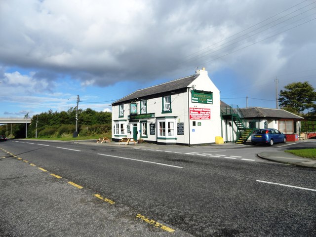
View of the Pemberton Arms, Cold Heseldon
Looking north along the B1432, the road leading to Seaham. The pub would seem to be late Victorian, as it is shown on the 1901 Ordnance Survey map, but not the 1862 one.
 Map © Crown Copyright")
TIP: Click the map for more Large scale mapping
- Grid Square
- NZ4146, 22 images (more nearby 🔍)
- Photographer
- Robert Graham (more nearby)
- Date Taken
- Wednesday, 9 October, 2013 (more nearby)
- Submitted
- Thursday, 19 December, 2013
- Subject Location
-
OSGB36:
 NZ 4116 4663 [10m precision]
WGS84: 54:48.7708N 1:21.6645W - Camera Location
-
OSGB36: NZ 4116 4657
- View Direction
- NORTH (about 0 degrees)