2013
SO4546 : Blackcurrant crop at Tillington Common
taken 10 years ago, near to Tillington Common, County of Herefordshire, England
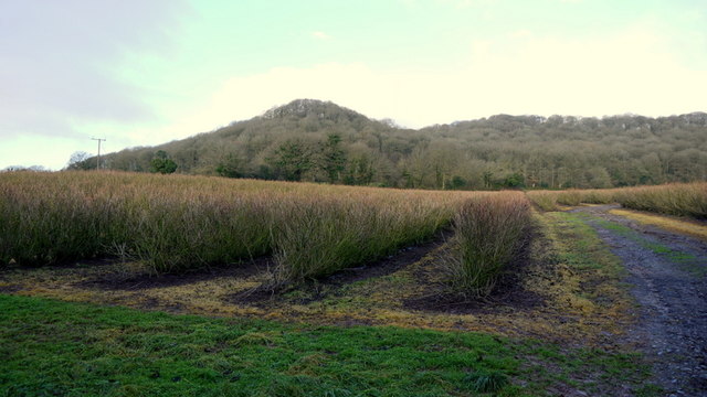
Blackcurrant crop at Tillington Common
The prominent hill is Round Oak Hill.
Not a lot has changed since the first Geograph for this square taken in March 2006, SO4546 : Fruit bushes at Woodfield Farm, Tillington Common.
Not a lot has changed since the first Geograph for this square taken in March 2006, SO4546 : Fruit bushes at Woodfield Farm, Tillington Common.
 Map © Crown Copyright")
TIP: Click the map for more Large scale mapping
- Grid Square
- SO4546, 15 images (more nearby 🔍)
- Photographer
- Jonathan Billinger (more nearby)
- Date Taken
- Friday, 20 December, 2013 (more nearby)
- Submitted
- Friday, 20 December, 2013
- Subject Location
-
OSGB36:
 SO 4535 4626 [10m precision]
WGS84: 52:6.7170N 2:47.9670W - Camera Location
-
OSGB36: SO 4541 4618
- View Direction
- Northwest (about 315 degrees)