SP2754 : Entrance to the new housing estate
taken 10 years ago, near to Wellesbourne, Warwickshire, England
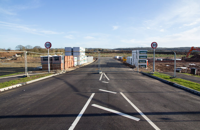
The highway stops at the fence and the estate roads have started to be laid prior to house building commencing.
Compare with SP2754 : Road to nowhere taken two months earlier.
A large new housing development of approximately 175 homes is being built to the east of the A429 on the southern outskirts of Wellesbourne village.
It has been named Ettington Park, although there is some local feeling that it should have been called Redlands Park after the nursery that originally occupied the site. The original Ettington Park is a country house turned hotel not far away from here. Link
The lead developer is Charles Church (Persimmon). LinkLink
A quantity of "Independent Living Extra Care Housing for older people" is being built by Orbit Homes as an integral part of the development. Link
The first stage of the development started on 22nd. July 2013, with the construction of a Section 278 roundabout (one funded by the developers), which was planned to take 14 weeks to construct. The contractor is McVeigh Construction working on behalf of Warwickshire County Council. Link
The work building the new houses appeared to go quite quickly and a number were occupied by November / December 2014, in time for Xmas.
 Map © Crown Copyright")
- Grid Square
- SP2754, 174 images (more nearby 🔍)
- Photographer
- David P Howard (more nearby)
- Date Taken
- Wednesday, 25 December, 2013 (more nearby)
- Submitted
- Wednesday, 25 December, 2013
- Subject Location
-
OSGB36:
 SP 2763 5458 [10m precision]
WGS84: 52:11.3266N 1:35.8352W - Camera Location
-
OSGB36: SP 2761 5458
- View Direction
- EAST (about 90 degrees)