2003
TF3606 : Across the fields to the remains of Murrow West station
taken 21 years ago, near to Murrow, Cambridgeshire, England
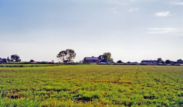
Across the fields to the remains of Murrow West station
View SW, across the course of the former M&GN Joint Railway: ex-GN&GE Joint main line March (to left) - (to right) Spalding - Sleaford - Lincoln - Doncaster. The station was closed 6/7/53 and following the closure of the principal Whitemoor Marshalling Yard at March, the March - Spalding section of line was closed 28/11/82. Until closed 2/3/59, there had been an unusual level-crossing of this line with the Peterborough North - Sutton Bridge section of the M&GN Railway, to the left here, at Murrow East station. (Both stations were called plain 'Murrow' until 27/9/48, i.e. after Nationalisation).
 Map © Crown Copyright")
TIP: Click the map for more Large scale mapping
- Grid Square
- TF3606, 5 images (more nearby 🔍)
- Photographer
- Ben Brooksbank (more nearby)
- Date Taken
- Tuesday, 15 July, 2003 (more nearby)
- Submitted
- Friday, 27 December, 2013
- Subject Location
-
OSGB36:
 TF 369 063 [100m precision]
WGS84: 52:38.2523N 0:1.3160E - Camera Location
-
OSGB36: TF 370 065
- View Direction
- Southwest (about 225 degrees)