2013
TA1756 : Site of former slipway-Ulrome
taken 10 years ago, near to Ulrome, East Riding of Yorkshire, England
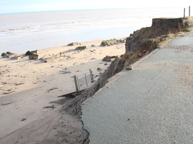
Site of former slipway-Ulrome
The large piece of concrete with the railings which is now on the beach was only last year up level with the road and prevented people walking off the sheer drop beyond, alas this has succumbed to erosion too-nothing is safe here.
 Map © Crown Copyright")
TIP: Click the map for more Large scale mapping
- Grid Square
- TA1756, 141 images (more nearby 🔍)
- Photographer
- Tracey Anne Taylor (more nearby)
- Contributed by
- phillip andrew carl taylor (more nearby)
- Date Taken
- Sunday, 22 December, 2013 (more nearby)
- Submitted
- Saturday, 28 December, 2013
- Subject Location
-
OSGB36:
 TA 1769 5657 [10m precision]
WGS84: 53:59.5065N 0:12.3822W - Camera Location
-
OSGB36: TA 1767 5661
- View Direction
- South-southeast (about 157 degrees)