2013
SP9113 : Evening view across Startopsend Reservoir
taken 10 years ago, near to Marsworth, Buckinghamshire, England
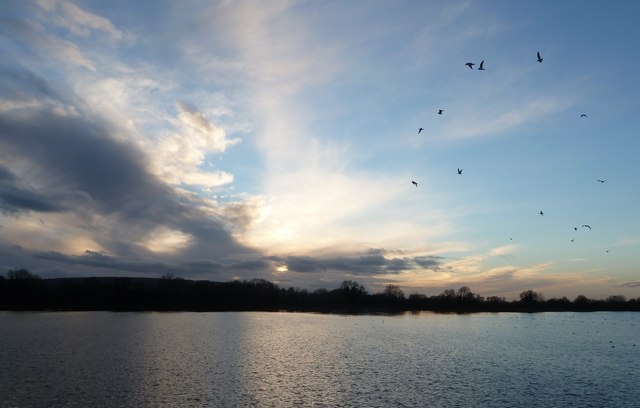
Evening view across Startopsend Reservoir
Looking across Startopsend Reservoir as the sun sets on a winter's day. A few seagulls fly lazily above its surface, soon to land. See also SP9113 : Sunset over Startopsend Reservoir for zoomed view and SP9213 : Startopsend Reservoir and hide for more information about the reservoir.
Startopsend (or just Startops) Reservoir, near Tring :: SP9114
Startopsend Reservoir was opened in 1817 to provide water for the Grand Junction Canal (now the Grand Union Canal). All but the section of the reservoir adjacent to the Marsworth Reservoir dam are in SP9113. Most of Startopsend Reservoir is in Hertfordshire, but the northernmost part is in Buckinghamshire. It differs from the other reservoirs in the area in that it has very little natural vegetation. It has the Marsworth Reservoir dam on its eastern flank, plus the road on the Tringford Reservoir dam. The Northern edge separates it from the Grand Union Canal and the South West and North West sides are also dams. It takes the overflow water from Marsworth and Tringford Reservoirs and has no direct supply of water.
 Map © Crown Copyright")
TIP: Click the map for more Large scale mapping
- Grid Square
- SP9113, 176 images (more nearby 🔍)
- Photographer
- Rob Farrow (more nearby)
- Date Taken
- Saturday, 28 December, 2013 (more nearby)
- Submitted
- Tuesday, 31 December, 2013
- Subject Location
-
OSGB36:
 SP 918 136 [100m precision]
WGS84: 51:48.8585N 0:40.1565W - Camera Location
-
OSGB36: SP 919 139
- View Direction
- Southwest (about 225 degrees)