1968
TQ6982 : The Stanford - Corringham 'canal' of September 1968
taken 56 years ago, near to Corringham, Thurrock, England
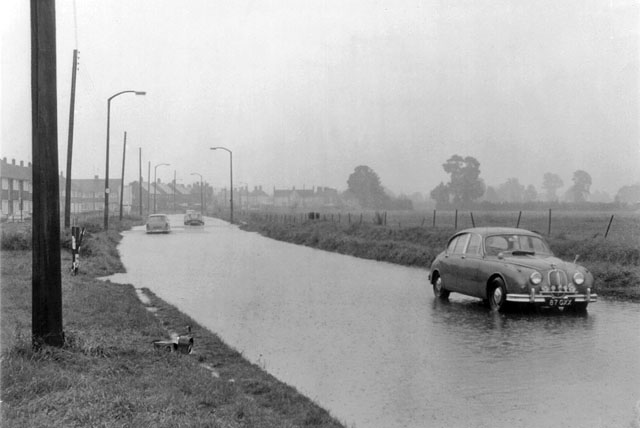
The Stanford - Corringham 'canal' of September 1968
Extremely heavy rainfall has flooded the A1014 (then single carriageway). On 15 and 16 September over 200 mm of rain fell in two days as measured at nearby Tilbury weather station. The road here is on fairly high ground (for the area), so the water is largely the result of the rate of rainfall overcoming the capacity of the road drains. The stationary Jaguar appears to have pegged out after getting through the deeper water in the distance.
 Map © Crown Copyright")
TIP: Click the map for more Large scale mapping
- Grid Square
- TQ6982, 24 images (more nearby 🔍)
- Photographer
- Robin Webster (more nearby)
- Date Taken
- 16 September 1968 (more nearby)
- Submitted
- Tuesday, 31 December, 2013
- Subject Location
-
OSGB36:
 TQ 6999 8299 [10m precision]
WGS84: 51:31.2149N 0:26.9258E - Camera Location
-
OSGB36: TQ 6996 8297
- View Direction
- Northeast (about 45 degrees)