2014
SP2965 : Riverside Walk by Emscote Gardens, Warwick 2014, January 7
taken 10 years ago, near to Warwick, Warwickshire, England
This is 1 of 2 images, with title starting with Riverside Walk by Emscote Gardens in this square
Riverside Walk by Emscote Gardens, Warwick 2014, January 7
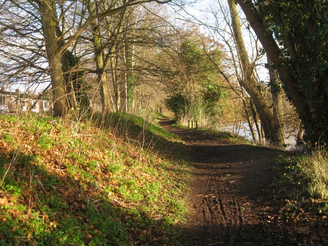
The path runs halfway up a floodbank behind Mercia Way. There is a steep drop to the river. The planted trees lean every which way, competing for light. Big hybrid poplars throw shadows across the path.
The Riverside Walk follows rivers and the canal between Warwick and Leamington and beyond: Newbold Comyn and Offchurch. Warwickshire's Centenary Way follows this stretch.
The Riverside Walk follows rivers and the canal between Warwick and Leamington and beyond: Newbold Comyn and Offchurch. Warwickshire's Centenary Way follows this stretch.
See other images of River Avon, Warwick, winter 2013-14
See other images of Poplars by the River Avon, Emscote Gardens, Warwick 2014-15
 Map © Crown Copyright")
TIP: Click the map for more Large scale mapping
- Grid Square
- SP2965, 1818 images (more nearby 🔍)
- Photographer
- Robin Stott (more nearby)
- Date Taken
- Tuesday, 7 January, 2014 (more nearby)
- Submitted
- Wednesday, 8 January, 2014
- Subject Location
-
OSGB36:
 SP 2953 6519 [10m precision]
WGS84: 52:17.0438N 1:34.1123W - Camera Location
-
OSGB36: SP 2949 6517
- View Direction
- Northeast (about 45 degrees)