2013
SD8330 : Hameldon and Hapton
taken 10 years ago, 3 km from Loveclough, Lancashire, England
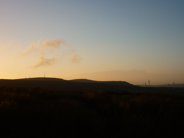
Hameldon and Hapton
Taken as I near the bottom of Crown Point Road where it meets the A682 Manchester Road, I am looking across Micklehurst to Hameldon Hill and Hapton Park, Burnley, Lancashire.
 Map © Crown Copyright")
TIP: Click the map for more Large scale mapping
- Grid Square
- SD8330, 39 images (more nearby 🔍)
- Photographer
- Carroll Pierce (more nearby)
- Date Taken
- Tuesday, 31 December, 2013 (more nearby)
- Submitted
- Sunday, 12 January, 2014
- Subject Location
-
OSGB36:
 SD 830 300 [100m precision]
WGS84: 53:45.9911N 2:15.5171W - Camera Location
-
OSGB36: SD 833 301
- View Direction
- West-southwest (about 247 degrees)