2014
NX2763 : Burial cairn
taken 10 years ago, 3 km from Barlae, Dumfries And Galloway, Scotland
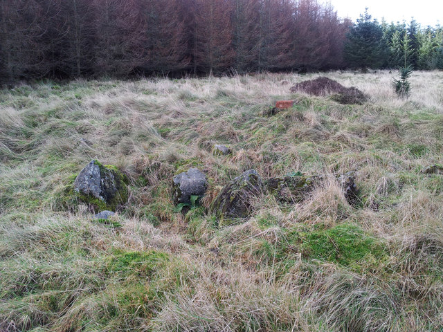
Burial cairn
This grass covered mound is an ancient burial cairn. When the area was first planted by the Forestry Commission in the 1960's, the cairn was ploughed through and badly damaged. The last time I visited it was about 12 years ago at which time it was deep within a maturing conifer plantation which has since been clearfelled and replanted, and more enlightened forestry practice has ensured that the immediate area around the cairn has now been left unplanted. The cairn has grown a thick covering of grass, but the damage done 50 years ago is clear to see in these disturbed boulders, possibly the remains of a cist.
 Map © Crown Copyright")
TIP: Click the map for more Large scale mapping
- Grid Square
- NX2763, 6 images (more nearby 🔍)
- Photographer
- David Baird (more nearby)
- Date Taken
- Sunday, 2 February, 2014 (more nearby)
- Submitted
- Monday, 3 February, 2014
- Subject Location
-
OSGB36:
 NX 2733 6365 [10m precision]
WGS84: 54:56.2531N 4:41.8140W - Camera Location
-
OSGB36: NX 2735 6365
- View Direction
- WEST (about 270 degrees)