2014
SO6875 : The River Rea in full flow
taken 10 years ago, near to Cleobury Mortimer, Shropshire, England
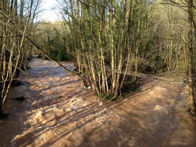
The River Rea in full flow
 Map © Crown Copyright")
TIP: Click the map for more Large scale mapping
- Grid Square
- SO6875, 15 images (more nearby 🔍)
- Photographer
- Mr M Evison (more nearby)
- Date Taken
- Sunday, 26 January, 2014 (more nearby)
- Submitted
- Monday, 3 February, 2014
- Subject Location
-
OSGB36:
 SO 6867 7563 [10m precision]
WGS84: 52:22.6683N 2:27.7000W - Camera Location
-
OSGB36: SO 68682 75614
- View Direction
- North-northwest (about 337 degrees)