2014
SX8386 : River junction, Christow station
taken 10 years ago, near to Christow, Devon, England
This is 1 of 2 images, with title River junction, Christow station in this square
River junction, Christow station
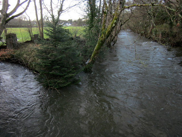
The confluence of the Rookery Brook and the River Teign (right) shown in SX8386 : River junction, Christow station from a different angle. Bridge piers at left and right indicate where the Bridford Quarry line crossed both watercourses. The conifer re-appears. Behind is the field shown in SX8386 : French's Field.
 Map © Crown Copyright")
TIP: Click the map for more Large scale mapping
- Grid Square
- SX8386, 51 images (more nearby 🔍)
- Photographer
- Derek Harper (more nearby)
- Date Taken
- Sunday, 9 February, 2014 (more nearby)
- Submitted
- Wednesday, 12 February, 2014
- Subject Location
-
OSGB36:
 SX 8386 8673 [10m precision]
WGS84: 50:40.1171N 3:38.6888W - Camera Location
-
OSGB36: SX 8387 8672
- View Direction
- Northwest (about 315 degrees)