2014
NX3458 : Sheep pasture and floodwater
taken 10 years ago, near to Spittal, Dumfries And Galloway, Scotland
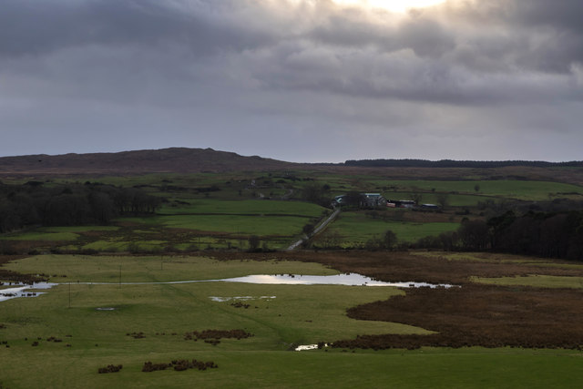
Sheep pasture and floodwater
After a long wet winter, many fields have large areas of standing water. Here the view is towards Gass farm with Craigeach Fell in the distance.
 Map © Crown Copyright")
TIP: Click the map for more Large scale mapping
- Grid Square
- NX3458, 11 images (more nearby 🔍)
- Photographer
- David Baird (more nearby)
- Date Taken
- Saturday, 15 February, 2014 (more nearby)
- Submitted
- Monday, 17 February, 2014
- Subject Location
-
OSGB36:
 NX 3422 5816 [10m precision]
WGS84: 54:53.4363N 4:35.1785W - Camera Location
-
OSGB36: NX 3470 5855
- View Direction
- Southwest (about 225 degrees)