2005
SH5085 : St Gallgo's Church, Llanallgo
taken 19 years ago, near to Llanallgo, Isle of Anglesey/Sir Ynys Mon, Wales
This is 1 of 2 images, with title St Gallgo's Church, Llanallgo in this square
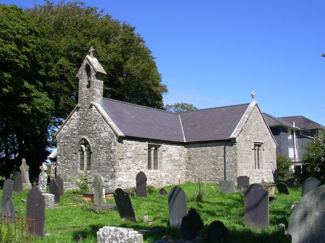
St Gallgo's Church, Llanallgo
This church on the A5025 dates from the 7th Century. Buried in the church grounds are 140 victims of the wreck of the Royal Charter, which sank near here in 1859. taken from SH502851.
 Map © Crown Copyright")
TIP: Click the map for more Large scale mapping
- Grid Square
- SH5085, 48 images (more nearby 🔍)
- Photographer
- Keith Williamson (more nearby)
- Date Taken
- Wednesday, 10 August, 2005 (more nearby)
- Submitted
- Tuesday, 16 August, 2005
- Subject Location
-
OSGB36:
 SH 502 851 [100m precision]
WGS84: 53:20.4916N 4:15.0900W