2014
SU2278 : Tumuli, Shipley Bottom
taken 10 years ago, near to Upper Upham, Wiltshire, England
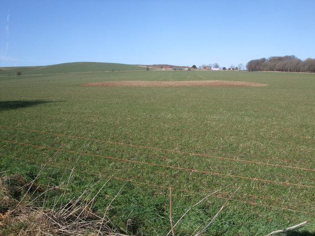
Tumuli, Shipley Bottom
Two Bronze Age tumuli (near distance, centre), seen from the byway running through Shipley Bottom, both damaged by ploughing. The western one (left) Link (Archive Link ) now seems almost indistinguishable from the eastern one (right). Link (Archive Link ) The latter was excavated by A.D. Passmore, who found a primary cremation and part of an incense cup. Both are now only 0.5 metres high, but were surrounded by quarry ditches about 2 metres wide from which material was taken for construction of the monuments.
In the distance is Liddington Warren Farm.
In the distance is Liddington Warren Farm.
 Map © Crown Copyright")
TIP: Click the map for more Large scale mapping
- Grid Square
- SU2278, 20 images (more nearby 🔍)
- Photographer
- Vieve Forward (more nearby)
- Date Taken
- Sunday, 16 February, 2014 (more nearby)
- Submitted
- Saturday, 22 February, 2014
- Subject Location
-
OSGB36:
 SU 2289 7854 [10m precision]
WGS84: 51:30.3200N 1:40.2958W - Camera Location
-
OSGB36: SU 2295 7849
- View Direction
- Northwest (about 315 degrees)