2014
SK5347 : Off Robin Hood Way, Hucknall Aerodrome Vicinity, Notts
taken 10 years ago, near to Bestwood Village, Nottinghamshire, England
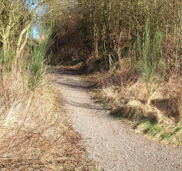
Off Robin Hood Way, Hucknall Aerodrome Vicinity, Notts.
This 'secondary' path leaves the Bestwood Country Park/Moor Bridge tram stop section of the Robin Hood Way in the vicinity of the eastern perimeter of Hucknall Aerodrome and can be seen here climbing up the side of a former railway embankment. Between 1899-1996 this embankment carried Great Central Main Line Railway trains between Manchester-London (via Sheffield, Nottingham, Leicester and Rugby. This secondary path leads to Farley's Lane, Hucknall, passing beneath the A611 (Hucknall By-Pass) on its way.
 Map © Crown Copyright")
TIP: Click the map for more Large scale mapping
- Grid Square
- SK5347, 32 images (more nearby 🔍)
- Photographer
- David Hallam-Jones (more nearby)
- Date Taken
- Saturday, 22 February, 2014 (more nearby)
- Submitted
- Saturday, 22 February, 2014
- Subject Location
-
OSGB36:
 SK 5394 4712 [10m precision]
WGS84: 53:1.1202N 1:11.8421W - Camera Location
-
OSGB36: SK 5394 4711
- View Direction
- NORTH (about 0 degrees)