2007
SY1793 : Ravine in Bullhall Wood
taken 17 years ago, 3 km from Farway, Devon, England
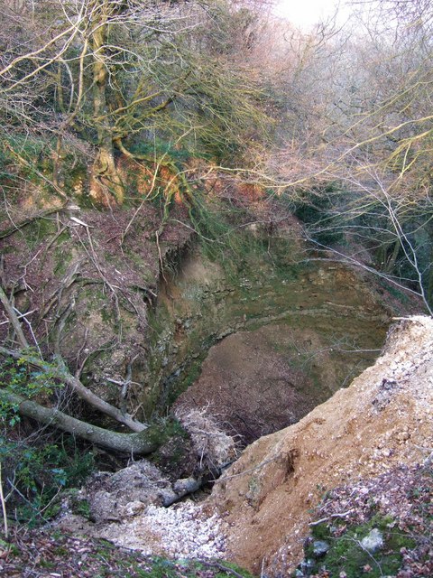
Ravine in Bullhall Wood
One of the heads of Wiscombe, which has dramatically cut into the East Devon Plateau, revealing the instability of the rock once the overlying tree cover has been removed. A collapsed tree lies at the foot. Southleigh Bridleway 14 runs a few feet away along the edge of the chasm, separated from it by a rather vulnerable old bank.
 Map © Crown Copyright")
TIP: Click the map for more Large scale mapping
- Grid Square
- SY1793, 9 images (more nearby 🔍)
- Photographer
- Derek Harper (more nearby)
- Date Taken
- Monday, 2 April, 2007 (more nearby)
- Submitted
- Monday, 2 April, 2007
- Subject Location
-
OSGB36:
 SY 1743 9326 [10m precision]
WGS84: 50:43.9839N 3:10.2820W - Camera Location
-
OSGB36: SY 1739 9327
- View Direction
- East-southeast (about 112 degrees)