2014
NF8344 : Admiralty Trig Point Plaque
taken 10 years ago, near to Sandwick, South Uist & Benbecula, Na h-Eileanan an Iar, Scotland
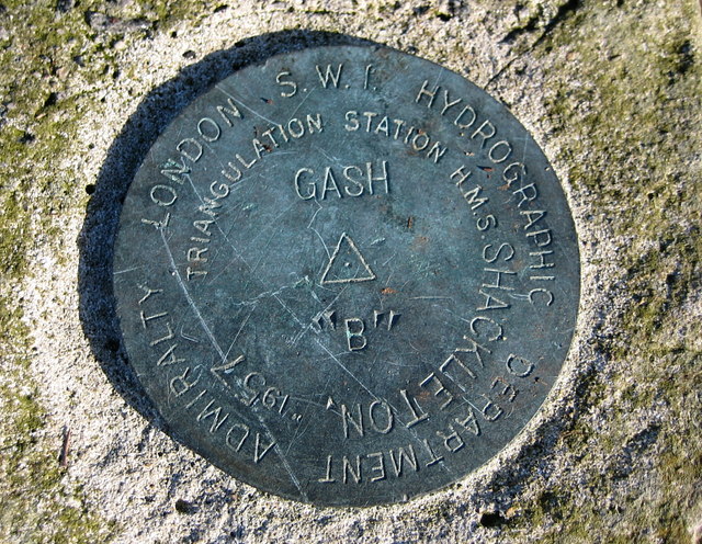
Admiralty Trig Point Plaque
Detail of the Admiralty trig point plaque on Sloc an Tairbh.
 Map © Crown Copyright")
TIP: Click the map for more Large scale mapping
- Grid Square
- NF8344, 4 images (more nearby 🔍)
- Photographer
- Rupert Fleetingly (more nearby)
- Date Taken
- Wednesday, 26 February, 2014 (more nearby)
- Submitted
- Wednesday, 26 February, 2014
- Subject Location
-
OSGB36:
 NF 8333 4417 [10m precision]
WGS84: 57:22.6438N 7:16.2534W - Camera Location
-
OSGB36: NF 8333 4417
- View Direction
- NORTH (about 0 degrees)