2014
J3178 : The Horseshoe Bend, Belfast - March 2014(3)
taken 10 years ago, 5 km NNW of Belfast, Co Antrim, Northern Ireland
The Horseshoe Bend, Belfast - March 2014(3)
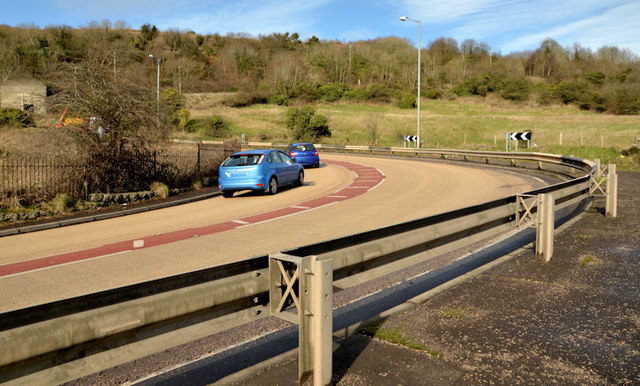
The outward/uphill view taken part way along the bend. This section of the crash barrier protects the footpath.
The Horseshoe Bend, Crumlin Road, Belfast
A sharp bend to the left, on a steep gradient, at a height of about 550ft, on the Crumlin Road, Belfast as it climbs towards Nutts Corner and Crumlin. The road was once the main road from Belfast to the International (Aldergrove) Airport until replaced by the present route via the M2 and Templepatrick. Its now the limit of developed Belfast. The historic 6 map (date unknown but from the pre-railway era) available on the OSI website does not show anything even remotely resembling a hairpin bend but does confirm that Belfast was a long way from expanding up the hill on the Crumlin Road.
There is now an anti-skid road surface.
Loading map... (JavaScript required)
- Grid Square
- J3178, 11 images (more nearby 🔍)
- Photographer
- Albert Bridge (more nearby)
- Date Taken
- Tuesday, 4 March, 2014 (more nearby)
- Submitted
- Tuesday, 4 March, 2014
- Subject Location
-
Irish:
 J 311 782 [100m precision]
WGS84: 54:38.1323N 5:58.1414W - Camera Location
-
Irish: J 312 782
- View Direction
- West-northwest (about 292 degrees)