2014
SU5025 : Flood south of Fawley Lane
taken 10 years ago, near to Morestead, Hampshire, England
Flood south of Fawley Lane
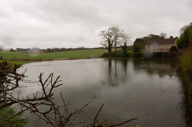
Normally a field of grass, this has become a lake. The lake water is flowing rightwards through the hedge and onto the Morestead Road. The house beyond, which is on higher ground, is named Orchard house.
Flood at junction of Morestead and Hazeley Roads :: SU5024
This junction floods quite often, but not usually as badly as shown in these photos which were taken during the wettest winter for many years. Water from the farmland to the east of the Morestead Road arrives at the junction which is a local low point. It has nowhere to go unless it can drain into the chalk, which it can't when the water table rises after prolonged rainfall. After the flood has built up sufficiently it can flow down the drive of the Lime Centre, and then along the valley to Twyford, where it causes another flood.
 Map © Crown Copyright")
TIP: Click the map for more Large scale mapping
- Grid Square
- SU5025, 68 images (more nearby 🔍)
- Photographer
- Peter Facey (more nearby)
- Date Taken
- Wednesday, 12 February, 2014 (more nearby)
- Submitted
- Wednesday, 5 March, 2014
- Subject Location
-
OSGB36:
 SU 5091 2562 [10m precision]
WGS84: 51:1.6620N 1:16.5259W - Camera Location
-
OSGB36: SU 5088 2564
- View Direction
- East-southeast (about 112 degrees)