2007
SE0122 : Crow Hill
taken 17 years ago, near to Cotton Stones, Calderdale, England
This is 1 of 3 images, with title Crow Hill in this square
Crow Hill
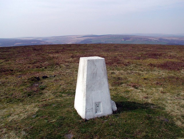
Triangulation pillar (flush bracket number S4371) on the exposed top of Crow Hill at 383 metres above sea level. The tiny spike on the distant horizon is the 110 foot high Stoodley Pike Monument. Link
 Map © Crown Copyright")
TIP: Click the map for more Large scale mapping
- Grid Square
- SE0122, 78 images (more nearby 🔍)
- Photographer
- Paul Glazzard (more nearby)
- Date Taken
- Monday, 2 April, 2007 (more nearby)
- Submitted
- Wednesday, 4 April, 2007
- Subject Location
-
OSGB36:
 SE 019 228 [100m precision]
WGS84: 53:42.1356N 1:58.3346W - Camera Location
-
OSGB36: SE 019 228
- View Direction
- West-northwest (about 292 degrees)