2014
SU4882 : River Pang beyond the A34
taken 10 years ago, near to East Ilsley, West Berkshire, England
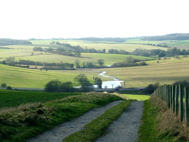
River Pang beyond the A34
The Pang stream is flowing from Hodcott in the dip in the distance to the right. It can first be glimpsed as it crosses the West Ilsley Road, then cuts across the base of Windmill Hill towards the A34 and East Ilsley.
Upper Pang - springs & sources :: SU4981
Following a winter of heavy rainfall, the chalk aquifer which feeds the River Pang has again become saturated, causing the groundwater to rise in many springs and pools for the second year in succession. In 2014 the westernmost sources of the Pang are rising beyond West Ilsley, and the usually dry upper sections of the Pang have flooded roads and houses in all the villages along its course.
 Map © Crown Copyright")
TIP: Click the map for more Large scale mapping
- Grid Square
- SU4882, 27 images (more nearby 🔍)
- Photographer
- Fly (more nearby)
- Date Taken
- Sunday, 16 February, 2014 (more nearby)
- Submitted
- Friday, 7 March, 2014
- Subject Location
-
OSGB36:
 SU 4886 8209 [10m precision]
WGS84: 51:32.1364N 1:17.8173W - Camera Location
-
OSGB36: SU 4955 8221
- View Direction
- WEST (about 270 degrees)