2014
SK3092 : Tour de France 2014 Route - Haggstones Road and Church Street Corner, Oughtibridge - 2
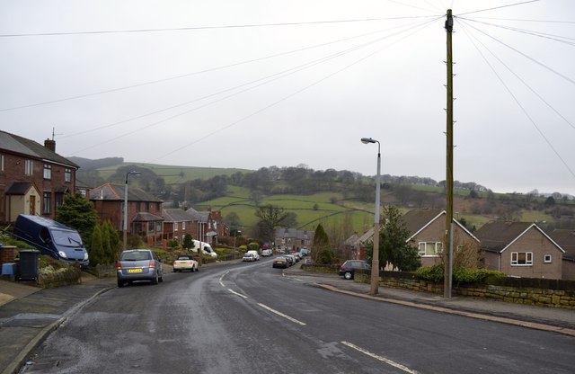
taken 10 years ago, near to Oughtibridge, Sheffield, England
This is 1 of 3 images, with title starting with Tour de France 2014 Route - Haggstones Road and Church Street Corner, Oughtibridge in this square
Tour de France 2014 Route - Haggstones Road and Church Street Corner, Oughtibridge - 2
This view is looking downhill towards the junction with Church Street.
Still about a mile of downhill travel for the riders to recover before the
Category Three Cote d'Oughtibridge climb, known locally as Jawbone Hill.
For more views in this area see
SK3092 : Tour de France 2014 Route - Haggstones Road and Church Street Corner, Oughtibridge - 1
SK3092 : Tour de France 2014 Route - Haggstones Road and Church Street Corner, Oughtibridge - 3
SK3093 : Tour de France 2014 Route - Haggstones Road and Church Street Corner, Oughtibridge - 4
SK3093 : Tour de France 2014 Route - Haggstones Road and Church Street Corner, Oughtibridge - 5
 Map © Crown Copyright")
TIP: Click the map for more Large scale mapping
- Grid Square
- SK3092, 140 images (more nearby 🔍)
- Photographer
- Terry Robinson (more nearby)
- Date Taken
- Saturday, 8 March, 2014 (more nearby)
- Submitted
- Monday, 10 March, 2014
- Subject Location
-
OSGB36:
 SK 3036 9293 [10m precision]
WGS84: 53:25.9372N 1:32.6707W - Camera Location
-
OSGB36: SK 3045 9285
- View Direction
- Northwest (about 315 degrees)