2014
SH6745 : Disused incline at Tan y grisiau
taken 10 years ago, near to Tanygrisiau, Gwynedd, Wales
This is 1 of 2 images, with title Disused incline at Tan y grisiau in this square
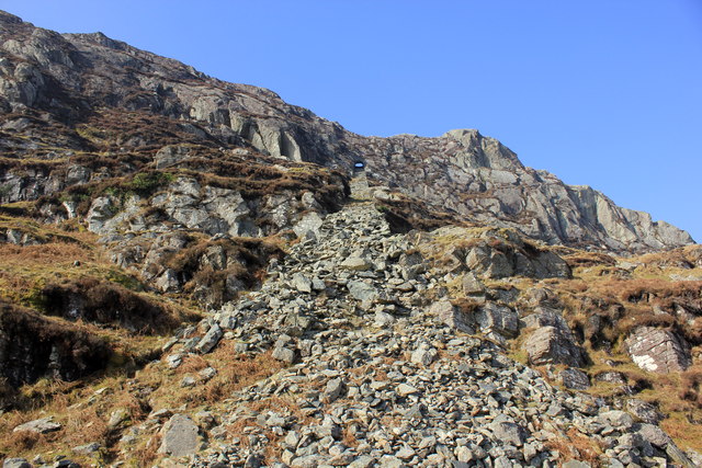
Disused incline at Tan y grisiau
Looking up at the disused incline from the old quarry at Craig-y-Wrysgan.
The incline as seen further up SH6745 : The incline near Craig yr Wrysgan
The incline as seen further up SH6745 : The incline near Craig yr Wrysgan
 Map © Crown Copyright")
TIP: Click the map for more Large scale mapping
- Grid Square
- SH6745, 68 images (more nearby 🔍)
- Photographer
- Jeff Buck (more nearby)
- Date Taken
- Wednesday, 12 March, 2014 (more nearby)
- Submitted
- Thursday, 13 March, 2014
- Subject Location
-
OSGB36:
 SH 6790 4529 [10m precision]
WGS84: 52:59.3166N 3:58.1627W - Camera Location
-
OSGB36: SH 6791 4526
- View Direction
- North-northwest (about 337 degrees)