2014
NS7130 : The blocked up 'alternative' course of the Ponesk Burn
taken 10 years ago, 4 km NNE of Muirkirk, East Ayrshire, Scotland
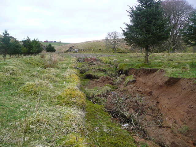
The blocked up 'alternative' course of the Ponesk Burn
 Map © Crown Copyright")
TIP: Click the map for more Large scale mapping
- Grid Square
- NS7130, 13 images (more nearby 🔍)
- Photographer
- Gordon Brown (more nearby)
- Date Taken
- Wednesday, 19 March, 2014 (more nearby)
- Submitted
- Wednesday, 19 March, 2014
- Subject Location
-
OSGB36:
 NS 7153 3059 [10m precision]
WGS84: 55:33.1218N 4:2.2822W - Camera Location
-
OSGB36: NS 71510 30576
- View Direction
- East-northeast (about 67 degrees)