2014
SK8300 : The route of the former A47
taken 10 years ago, near to Wardley, Rutland, England
This is 1 of 2 images, with title The route of the former A47 in this square
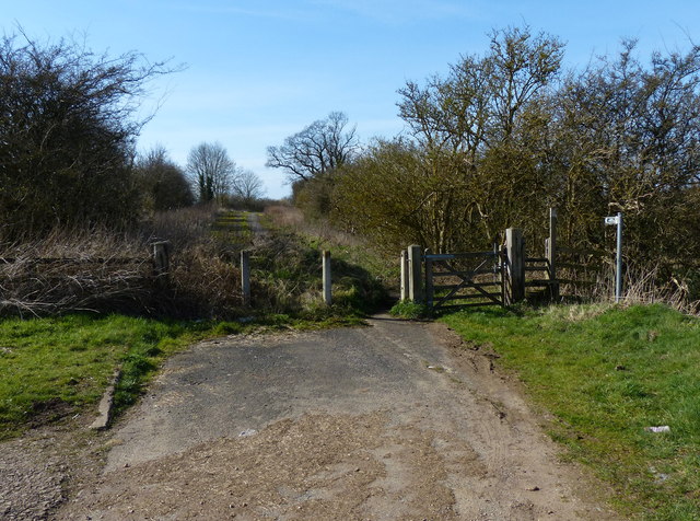
The route of the former A47
The two-mile £1.9 million Wardley Hill Improvement was opened in October 1987, making this road obsolete, it is slowly being encroached on after 27 years of disuse. A public footpath now follows the road.
 Map © Crown Copyright")
TIP: Click the map for more Large scale mapping
- Grid Square
- SK8300, 51 images (more nearby 🔍)
- Photographer
- Mat Fascione (more nearby)
- Date Taken
- Saturday, 15 March, 2014 (more nearby)
- Submitted
- Thursday, 20 March, 2014
- Subject Location
-
OSGB36:
 SK 839 005 [100m precision]
WGS84: 52:35.7709N 0:45.7320W - Camera Location
-
OSGB36: SK 839 005
- View Direction
- WEST (about 270 degrees)