2014
SK1170 : Chelmorton, Peak District
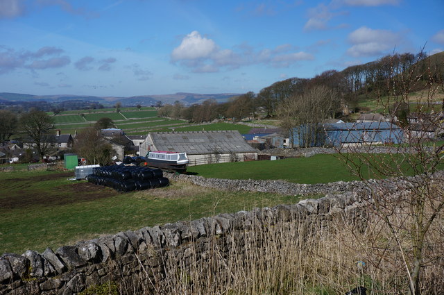
taken 10 years ago, near to Chelmorton, Derbyshire, England
This is 1 of 8 images, with title starting with Chelmorton in this square
Chelmorton, Peak District
There aren't many narrow boats in this village, but I managed to spot this one. It is about 400m above sea level. The nearest canal isn't that far really, Peak Forest Canal at Whaley Bridge, about 12 miles as the crow flies.
 Map © Crown Copyright")
TIP: Click the map for more Large scale mapping
- Grid Square
- SK1170, 103 images (more nearby 🔍)
- Photographer
- Peter Barr (more nearby)
- Date Taken
- Monday, 24 March, 2014 (more nearby)
- Submitted
- Monday, 24 March, 2014
- Subject Location
-
OSGB36:
 SK 1151 7009 [10m precision]
WGS84: 53:13.6638N 1:49.7428W - Camera Location
-
OSGB36: SK 1158 7004
- View Direction
- Northwest (about 315 degrees)