2014
SD5228 : Junction at the bottom of Fishergate Hill
taken 10 years ago, near to Higher Penwortham, Lancashire, England
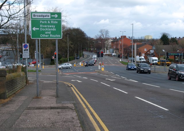
Junction at the bottom of Fishergate Hill
Road Junction where Liverpool road and Fishergate Hill meet, the road to the left is the A5072 going towards Riversway and the Docks. The Guild Wheel track is just out of sight and leads off to the left at the end of the wall.
 Map © Crown Copyright")
TIP: Click the map for more Large scale mapping
- Grid Square
- SD5228, 144 images (more nearby 🔍)
- Photographer
- Steve Houldsworth (more nearby)
- Date Taken
- Tuesday, 25 March, 2014 (more nearby)
- Submitted
- Thursday, 27 March, 2014
- Subject Location
-
OSGB36:
 SD 5286 2888 [10m precision]
WGS84: 53:45.2483N 2:42.9845W - Camera Location
-
OSGB36: SD 5281 2887
- View Direction
- East-northeast (about 67 degrees)