2014
TA0728 : Anlaby Road, Kingston upon Hull
taken 10 years ago, near to Kingston Upon Hull, England
This is 1 of 33 images, with title Anlaby Road, Kingston upon Hull in this square
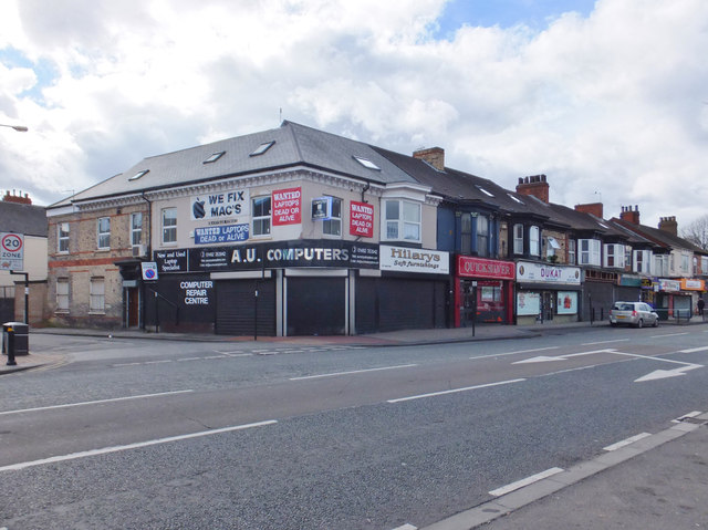
Anlaby Road, Kingston upon Hull
Between Granville Street and Sandringham Street, Nos.465 to 487 Anlaby Road were originally developed as Granville Terrace between 1875 and 1879, mostly as purpose-built shops.
 Map © Crown Copyright")
TIP: Click the map for more Large scale mapping
- Grid Square
- TA0728, 814 images (more nearby 🔍)
- Photographer
- Bernard Sharp (more nearby)
- Date Taken
- Sunday, 23 March, 2014 (more nearby)
- Submitted
- Friday, 28 March, 2014
- Subject Location
-
OSGB36:
 TA 0730 2869 [10m precision]
WGS84: 53:44.6133N 0:22.4709W - Camera Location
-
OSGB36: TA 0733 2873
- View Direction
- Southwest (about 225 degrees)