2014
NT2440 : Erosion at Fotheringham Bridge
taken 10 years ago, near to Peebles, Scottish Borders, Scotland
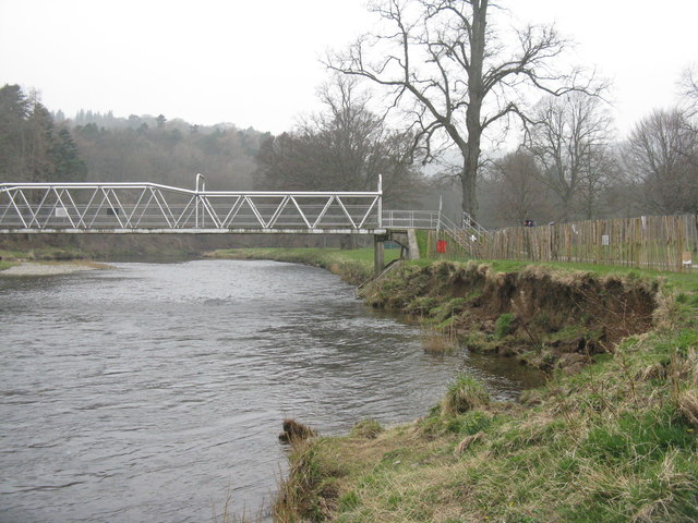
Erosion at Fotheringham Bridge
The north bank of the River Tweed crumbles into the river.
 Map © Crown Copyright")
TIP: Click the map for more Large scale mapping
- Grid Square
- NT2440, 499 images (more nearby 🔍)
- Photographer
- M J Richardson (more nearby)
- Date Taken
- Sunday, 30 March, 2014 (more nearby)
- Submitted
- Monday, 31 March, 2014
- Subject Location
-
OSGB36:
 NT 2425 4038 [10m precision]
WGS84: 55:39.0615N 3:12.3182W - Camera Location
-
OSGB36: NT 2428 4039
- View Direction
- West-southwest (about 247 degrees)