2014
SU6976 : Benchmark on #210 Upper Wodcote Road
taken 10 years ago, near to Tokers Green, Oxfordshire, England
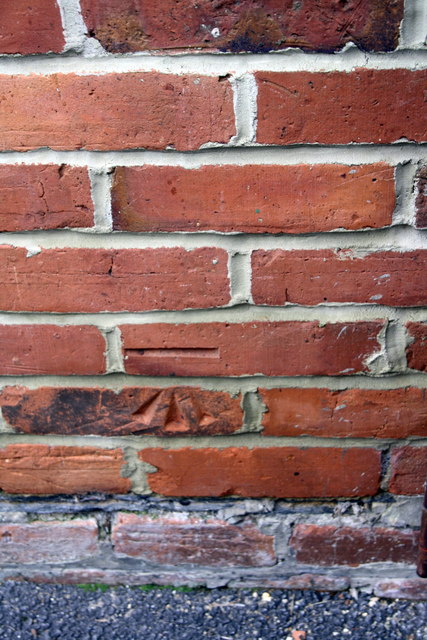
Benchmark on #210 Upper Wodcote Road
Ordnance Survey cut mark benchmark described on the bench Mark Database at Link
 Map © Crown Copyright")
TIP: Click the map for more Large scale mapping
- Grid Square
- SU6976, 25 images (more nearby 🔍)
- Photographer
- Roger Templeman (more nearby)
- Date Taken
- Tuesday, 11 March, 2014 (more nearby)
- Submitted
- Monday, 31 March, 2014
- Subject Location
-
OSGB36:
 SU 6976 7642 [10m precision]
WGS84: 51:28.9465N 0:59.8076W - Camera Location
-
OSGB36: SU 6976 7642
- View Direction
- SOUTH (about 180 degrees)