2014
SP6105 : Wheatley, With Flood
taken 10 years ago, near to Wheatley, Oxfordshire, England
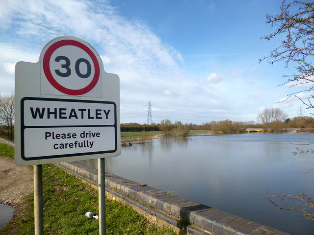
Wheatley, With Flood
There are quite a few Geographs of this scene. The water makes a nice picture and some sort of flood happens most years.
The Thame is a clay catchment and responds rapidly to any significant rainfall event. Extensive flooding of riverside land is not uncommon.
The Thame is a clay catchment and responds rapidly to any significant rainfall event. Extensive flooding of riverside land is not uncommon.
 Map © Crown Copyright")
TIP: Click the map for more Large scale mapping
- Grid Square
- SP6105, 36 images (more nearby 🔍)
- Photographer
- Des Blenkinsopp (more nearby)
- Date Taken
- Wednesday, 5 March, 2014 (more nearby)
- Submitted
- Tuesday, 1 April, 2014
- Subject Location
-
OSGB36:
 SP 6121 0529 [10m precision]
WGS84: 51:44.5787N 1:6.8922W - Camera Location
-
OSGB36: SP 6124 0521
- View Direction
- North-northwest (about 337 degrees)