2013
ST7560 : Midford Aqueduct
taken 11 years ago, near to South Stoke, Bath And North East Somerset, England
This is 1 of 5 images, with title Midford Aqueduct in this square
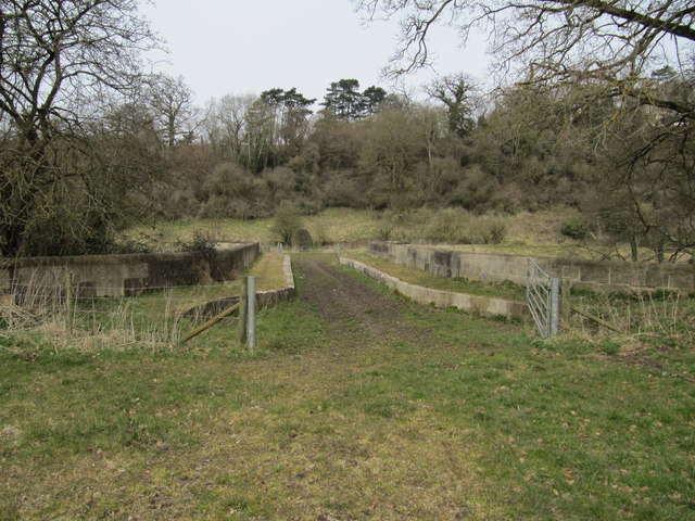
Midford Aqueduct
The stone-lined channel of the Somerset Coal Canal as it crosses Midford Aqueduct.
 Map © Crown Copyright")
TIP: Click the map for more Large scale mapping
- Grid Square
- ST7560, 25 images (more nearby 🔍)
- Photographer
- David Tyers (more nearby)
- Date Taken
- Sunday, 7 April, 2013 (more nearby)
- Submitted
- Wednesday, 2 April, 2014
- Subject Location
-
OSGB36:
 ST 757 605 [100m precision]
WGS84: 51:20.6000N 2:20.9468W - Camera Location
-
OSGB36: ST 757 605
- View Direction
- South-southeast (about 157 degrees)