2014
SU5798 : Bridge for B4015 over Baldon Brook
taken 10 years ago, near to Chiselhampton, Oxfordshire, England
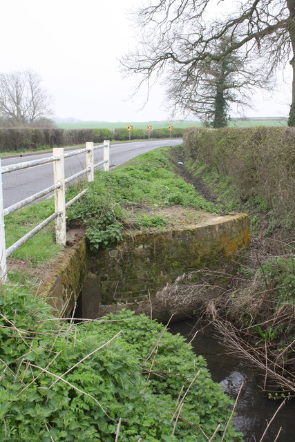
Bridge for B4015 over Baldon Brook
There is an OS benchmark SU5798 : Benchmark on bridge carrying B4015 over Baldon Brook on top of the concrete of the bridge where the soil has been cleared over the far bank of the brook
 Map © Crown Copyright")
TIP: Click the map for more Large scale mapping
- Grid Square
- SU5798, 12 images (more nearby 🔍)
- Photographer
- Roger Templeman (more nearby)
- Date Taken
- Tuesday, 1 April, 2014 (more nearby)
- Submitted
- Wednesday, 2 April, 2014
- Subject Location
-
OSGB36:
 SU 5761 9872 [10m precision]
WGS84: 51:41.0576N 1:10.0853W - Camera Location
-
OSGB36: SU 5763 9874
- View Direction
- Southwest (about 225 degrees)