2014
SU8266 : The Crooked Billet
taken 10 years ago, 3 km from Wokingham, England
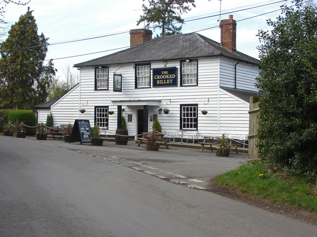
The Crooked Billet
The Crooked Billet public house at the junction of Redlake Lane and Honey Hill.
 Map © Crown Copyright")
TIP: Click the map for more Large scale mapping
- Grid Square
- SU8266, 39 images (more nearby 🔍)
- Photographer
- Alan Hunt (more nearby)
- Date Taken
- Tuesday, 1 April, 2014 (more nearby)
- Submitted
- Thursday, 3 April, 2014
- Subject Location
-
OSGB36:
 SU 8261 6670 [10m precision]
WGS84: 51:23.6001N 0:48.8428W - Camera Location
-
OSGB36: SU 8264 6667
- View Direction
- Northwest (about 315 degrees)