2014
SN7820 : Boulders on east side of Garreg Las
taken 10 years ago, 4 km S of Llanddeusant, Carmarthenshire/Sir Gaerfyrddin, Wales
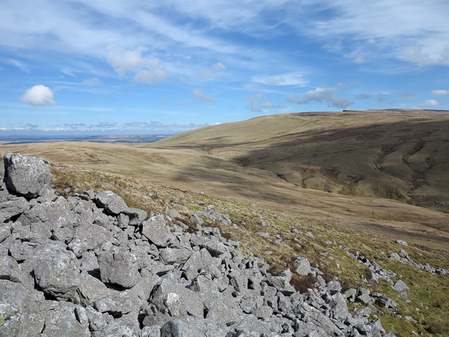
Boulders on east side of Garreg Las
The names Garreg Las and Twyn-Swnd both appear on maps close to the hill rising leftwards out of this image. Whichever name is applied, the hill top and its upper slopes are rocky with significant exposures of limestone both as solid rock and as fragments. As can be seen here the rockiness peters out to the east as a grassy slope descends towards the valley of the stream, Twrch Fechan, beyond which further grassy slopes rise to Waun Lefrith, part of Carmarthen Fan.
 Map © Crown Copyright")
TIP: Click the map for more Large scale mapping
- Grid Square
- SN7820, 10 images (more nearby 🔍)
- Photographer
- Trevor Littlewood (more nearby)
- Date Taken
- Tuesday, 1 April, 2014 (more nearby)
- Submitted
- Wednesday, 9 April, 2014
- Subject Location
-
OSGB36:
 SN 781 205 [100m precision]
WGS84: 51:52.2315N 3:46.3099W - Camera Location
-
OSGB36: SN 780 205
- View Direction
- Northeast (about 45 degrees)