2014
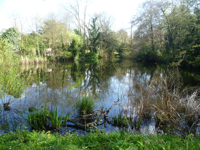
TQ4265 : The lake in Hollydale Recreation Ground
taken 10 years ago, near to Keston, Bromley, England
This is 1 of 2 images, with title The lake in Hollydale Recreation Ground in this square
The lake in Hollydale Recreation Ground
Hollydale Recreation Ground is formed from the former grounds of Hollydale, an 18th century house. The local council bought some of the land and mansion in 1933, and the house was demolished at this time. By 1936, the northern and eastern parkland had been extensively developed for housing, but the lake and some woodland around it survived and forms the recreation ground seen today.
For more information on the park see Link (Archive Link )
This view is from the dam of the lake looking south.
For more information on the park see Link
This view is from the dam of the lake looking south.
 Map © Crown Copyright")
TIP: Click the map for more Large scale mapping
- Grid Square
- TQ4265, 72 images (more nearby 🔍)
- Photographer
- Marathon (more nearby)
- Date Taken
- Wednesday, 9 April, 2014 (more nearby)
- Submitted
- Saturday, 12 April, 2014
- Subject Location
-
OSGB36:
 TQ 4233 6535 [10m precision]
WGS84: 51:22.1628N 0:2.5978E - Camera Location
-
OSGB36: TQ 4232 6539
- View Direction
- South-southeast (about 157 degrees)