2014
NN3438 : Track by the Allt Kinglass
taken 10 years ago, near to Allt Kinglass [water Feature], Argyll And Bute, Great Britain
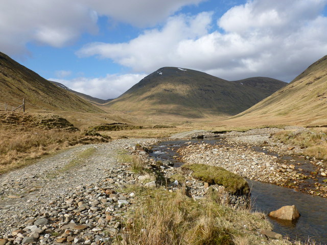
Track by the Allt Kinglass
The track up the Auch Gleann crosses and re-crosses the Allt Kinglass several times, with many fords to be negotiated. Beinn a' Chuirn ('mountain of the cairn') and Beinn Mhanach ('monk mountain') are the twin rounded tops in the background.
 Map © Crown Copyright")
TIP: Click the map for more Large scale mapping
- Grid Square
- NN3438, 6 images (more nearby 🔍)
- Photographer
- Alan O'Dowd (more nearby)
- Date Taken
- Monday, 14 April, 2014 (more nearby)
- Submitted
- Tuesday, 15 April, 2014
- Subject Location
-
OSGB36:
 NN 3495 3826 [10m precision]
WGS84: 56:30.4417N 4:41.0125W - Camera Location
-
OSGB36: NN 3492 3822
- View Direction
- North-northeast (about 22 degrees)