2014
SD5051 : Lancaster (Forton) services on the M6
taken 10 years ago, near to Forton, Lancashire, England
This is 1 of 2 images, with title starting with Lancaster (Forton) services in this square
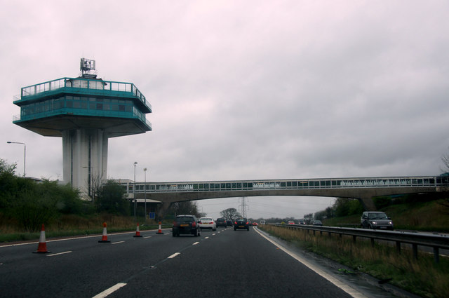
Lancaster (Forton) services on the M6
The 1960s saw the building of many concrete structures like this - because they could be done; the tower is no longer used. The tower straddles the grid boundary, with only the nearest part in this square.
 Map © Crown Copyright")
TIP: Click the map for more Large scale mapping
- Grid Square
- SD5051, 122 images (more nearby 🔍)
- Photographer
- Mike Pennington (more nearby)
- Date Taken
- Sunday, 6 April, 2014 (more nearby)
- Submitted
- Wednesday, 16 April, 2014
- Subject Location
-
OSGB36:
 SD 5023 5199 [10m precision]
WGS84: 53:57.6951N 2:45.6028W - Camera Location
-
OSGB36: SD 5028 5196
- View Direction
- West-northwest (about 292 degrees)