2014
NS3779 : Carman Hill-fort: sunken approach road
taken 10 years ago, near to Alexandria, West Dunbartonshire, Scotland
This is 1 of 2 images, with title Carman Hill-fort: sunken approach road in this square
Carman Hill-fort: sunken approach road
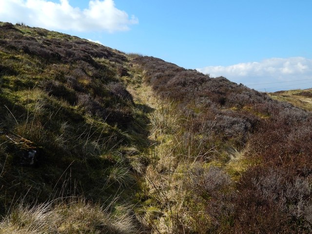
See NS3779 : Ancient hill-fort on Carman Hill for the main description of the hill-fort. Click on the end-note title for related pictures, and see the annotated satellite view linked from the end-note as an index to these pictures and their positions in the fort.
See also NS3779 : Carman Hill-fort: sunken approach road, a view along the approach road in the opposite direction. The present picture is a view up the slope, towards the edge of the fort. The fort is more or less circular in outline, and the approach road comes from the ENE, heading straight for the fort's northern edge; from that point, it then curves around towards the fort's western side.
Next topic hut circles:
NS3779 : Carman Hill-fort: possible hut-circle
NS3779 : Carman Hill-fort: possible hut-circle
Previous topic the annexe:
NS3779 : Carman Hill-fort: northern end of annexe
NS3779 : Carman Hill-fort: western wall of annexe
NS3779 : Carman Hill-fort: western wall of annexe
NS3779 : Carman Hill-fort: eastern wall of annexe
NS3779 : Carman Hill-fort: eastern wall of annexe
Carman Hill-fort
This large hill-fort see Link
(at Canmore) was identified in 1954 from aerial photographs, and is thought to date from the Early Historic period (Dark Ages). See Link for a Geograph article on the fort. See Link
 Map © Crown Copyright")
TIP: Click the map for more Large scale mapping
- Grid Square
- NS3779, 116 images (more nearby 🔍)
- Photographer
- Lairich Rig (more nearby)
- Date Taken
- Wednesday, 26 March, 2014 (more nearby)
- Submitted
- Thursday, 17 April, 2014
- Subject Location
-
OSGB36:
 NS 3718 7951 [10m precision]
WGS84: 55:58.8520N 4:36.6714W - Camera Location
-
OSGB36: NS 3721 7951
- View Direction
- WEST (about 270 degrees)