2014
ST3918 : Strode House and Barrington Court
taken 10 years ago, near to Barrington, Somerset, England
Strode House and Barrington Court
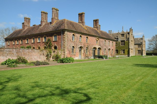
Strode House and Barrington Court viewed from the south-west. Strode house in the foreground was built in 1674 by William Strode II as a stable block. Barrington Court which is to the rear was built in the 1550s in local Ham Hill oolitic limestone by the Earl of Bridgewater who died before it was completed. By the beginning of the twentieth century the house was in a parlous and dilapidated state with the roof leaking and many of the windows bricked up. The property was acquired by the National Trust in 1907, as their first country estate. Much of the restoration was funded by three generations of the Lyle family (of Tate and Lyle) who were tenants from 1920 to 1991.
 Map © Crown Copyright")
TIP: Click the map for more Large scale mapping
- Grid Square
- ST3918, 178 images (more nearby 🔍)
- Photographer
- Philip Halling (more nearby)
- Date Taken
- Monday, 14 April, 2014 (more nearby)
- Submitted
- Friday, 18 April, 2014
- Subject Location
-
OSGB36:
 ST 3978 1825 [10m precision]
WGS84: 50:57.6308N 2:51.5300W - Camera Location
-
OSGB36: ST 3975 1823
- View Direction
- East-northeast (about 67 degrees)