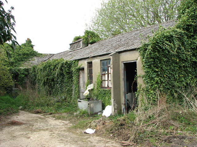
TG1338 : RAF West Beckham radar station (C Site)
taken 10 years ago, near to West Beckham, Norfolk, England
RAF West Beckham, which had close links with the local fighter station RAF Matlask, was opened in 1938 and comprised a transmitter and receiver site, a generator site and underground reserves. It reported to the filter room at RAF Watnall which was the HQ to No. 12 Group RAF, and the station was originally parented to RAF Bircham Newton, followed by later RAF Wittering and finally RAF Coltishall.
The radar site proper, located at Bodham Hill, was known as A Site. During World War II the station was commanded by the famous dance band leader Marius B. Winter and because of his background the soldiers based at the camp were very well entertained. A Site was closed in 1956.
There were also two separate camps: The B Site provided accommodation for the WAAFs and airmen from 1939 to 1946. The B Site, which was also known as "The Marlpit Camp" due to its close proximity to a disused marl pit - now a fishing lake > Link - was closed down in 1958.
Site C was home to the Royal Norfolk Regiment in 1940 and in 1941 was used by the Military Police, followed by an RAF regiment from 1942 until 1945. After the war the site went into care and maintenance.
Today the station is privately owned and many of the buildings are still in existence.
 Map © Crown Copyright")
- Grid Square
- TG1338, 46 images (more nearby 🔍)
- Photographer
- Evelyn Simak (more nearby)
- Date Taken
- Friday, 18 April, 2014 (more nearby)
- Submitted
- Friday, 18 April, 2014
- Subject Location
-
OSGB36:
 TG 1330 3888 [10m precision]
WGS84: 52:54.3000N 1:10.2174E - Camera Location
-
OSGB36: TG 1331 3887
- View Direction
- Northwest (about 315 degrees)