2014
ST3922 : Ordnance Survey Flush Bracket 1710
taken 10 years ago, near to Hambridge, Somerset, England
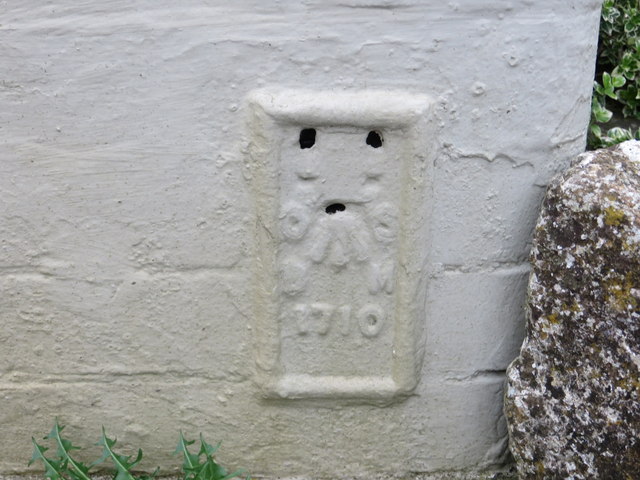
Ordnance Survey Flush Bracket 1710
This can be found on the wall of the former flour mill/brewery near Hambridge.
For more detail see : Link
For more detail see : Link
 Map © Crown Copyright")
TIP: Click the map for more Large scale mapping
- Grid Square
- ST3922, 12 images (more nearby 🔍)
- Photographer
- Peter Wood (more nearby)
- Date Taken
- Thursday, 3 April, 2014 (more nearby)
- Submitted
- Sunday, 20 April, 2014
- Subject Location
-
OSGB36:
 ST 39691 22340 [1m precision]
WGS84: 50:59.8367N 2:51.6468W