2014
ST9769 : Eastern elevation, Bowood House, Calne
taken 10 years ago, near to Studley, Wiltshire, England
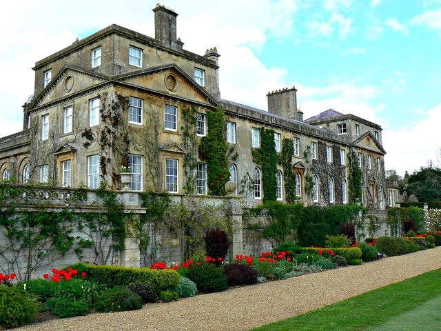
Eastern elevation, Bowood House, Calne
 Map © Crown Copyright")
TIP: Click the map for more Large scale mapping
- Grid Square
- ST9769, 103 images (more nearby 🔍)
- Photographer
- Brian Robert Marshall (more nearby)
- Date Taken
- Saturday, 19 April, 2014 (more nearby)
- Submitted
- Monday, 21 April, 2014
- Subject Location
-
OSGB36:
 ST 975 699 [100m precision]
WGS84: 51:25.7076N 2:2.2150W - Camera Location
-
OSGB36: ST 975 699
- View Direction
- West-northwest (about 292 degrees)