TL4458 : Corpus Christi College
taken 10 years ago, near to Cambridge, Cambridgeshire, England
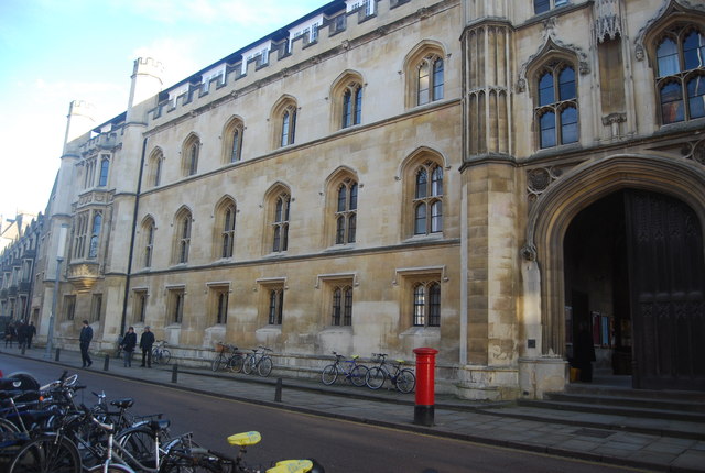
Corpus Christi College (full name: The College of Corpus Christi and the Blessed Virgin Mary, often shortened to "Corpus", or previously sometimes "The Body") is a constituent college of the University of Cambridge. It is notable as the only college founded by Cambridge townspeople: it was established in 1352 by the Guilds of Corpus Christi and the Blessed Virgin Mary, making it the sixth-oldest college in Cambridge. With around 500 students and fellows, it is also the second smallest of the traditional colleges of the University (after Peterhouse), and the smallest in terms of undergraduate student intake.
Grade I listed. Link
Wikipedia: Link
Trumpington Street is a major historic street in Cambridge. At the north end it continues as King's Parade. To the south it continues as Trumpington Road (the A1134), an arterial route out of Cambridge, at the junction with Lensfield Road.
The colleges St Catharine's College, Corpus Christi College, Pembroke College and Peterhouse are all on Trumpington Street. At the southern end is the main site of the Cambridge University Engineering Department.
The Church of St Mary the Less, Cambridge is next to Peterhouse. The Emmanuel United Reformed Church, built to a design of James Cubitt in 1875, is also located on Trumpington Street.
At the northern end on the corner of Corpus Christi College facing King's Parade is the Corpus Clock, a new tourist attraction installed in 2008.
 Map © Crown Copyright")
- Grid Square
- TL4458, 6189 images (more nearby 🔍)
- Photographer
- N Chadwick (more nearby)
- Date Taken
- Sunday, 12 January, 2014 (more nearby)
- Submitted
- Monday, 21 April, 2014
- Subject Location
-
OSGB36:
 TL 4482 5817 [10m precision]
WGS84: 52:12.1643N 0:7.0650E - Camera Location
-
OSGB36: TL 4481 5815
- View Direction
- North-northeast (about 22 degrees)