2014
NS5162 : The Blacksey Burn
taken 10 years ago, near to Waterside, East Renfrewshire, Scotland
This is 1 of 2 images, with title The Blacksey Burn in this square
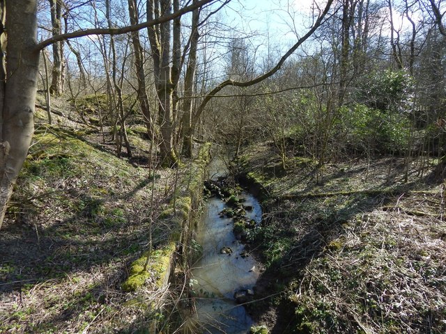
The Blacksey Burn
The burn is flowing towards the photographer's position. The picture was taken from the little footbridge shown in NS5162 : Footbridge over the Blacksey Burn.
On the map, the boundary that corresponds to the line of the burn is marked "Burgh Const., P Const., PER & UA Bdy".
The present picture shows the artificial channel through which the burn flows, explaining its unnaturally straight course, as depicted on the OS map. From the bridge, the burn flows only a few metres before joining the White Cart Water, as shown in the following picture, a view in the opposite direction from the same point: NS5162 : The Blacksey Burn.
 Map © Crown Copyright")
TIP: Click the map for more Large scale mapping
- Grid Square
- NS5162, 44 images (more nearby 🔍)
- Photographer
- Lairich Rig (more nearby)
- Date Taken
- Monday, 24 March, 2014 (more nearby)
- Submitted
- Tuesday, 22 April, 2014
- Subject Location
-
OSGB36:
 NS 5134 6270 [10m precision]
WGS84: 55:50.0735N 4:22.5134W - Camera Location
-
OSGB36: NS 5131 6272
- View Direction
- East-southeast (about 112 degrees)